By Jeff Freund, VP of Enterprise Solutions
COVID-19 has brought most in-person interactions to a screeching halt. With the wave of closures across the country, school campuses and businesses are vacant like never before. While this creates a set of unprecedented challenges, the opportunity to focus on facility infrastructure in a safe manner remains. With the lack of visitors, students, and employees onsite, facility health assessments can help ensure your structures will be ready to operate efficiently when society reopens.
What is a facility health assessment?
Facility health assessments include anything from evaluating roof and grounds conditions to inspecting the building’s exterior. With minimal disruptions at your facility in regard to visitors and staff, now is the time to assess your portfolio to plan and bring forward capital expenditures and deferred maintenance.
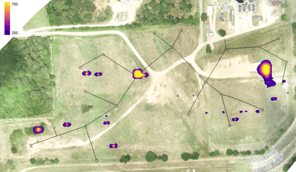
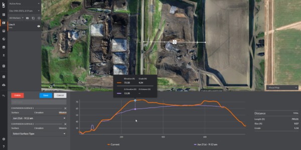
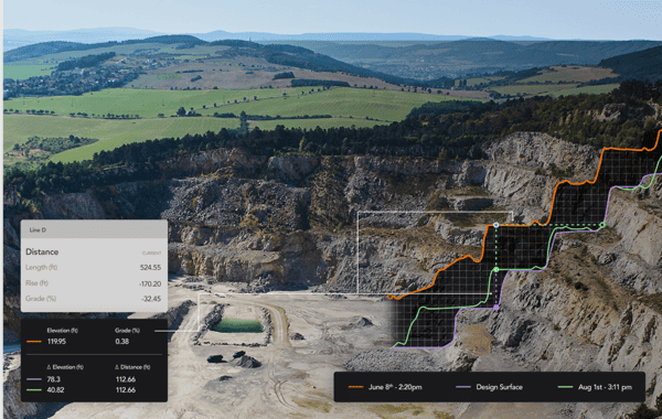
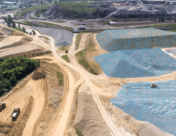
When it comes to building inspections, there are many tools available on the market. Now more than ever it is important that we provide cost effective solutions to our clients in collecting and processing data to help manage their facility. We’ve found a solution in combining terrestrial LiDAR and drone based aerial imagery. Using the combination of the two, Firmatek has successfully provided precise data to our customers with less than one inch per pixel accuracy. The two data collection tools allow us to provide ladder details, edge details, rooftop equipment details, openings, and navigation walkways. This information is valuable to facility managers and engineering teams to help with project planning.
With many commercial buildings looking to install solar panels on rooftops, such data can be critical in helping engineers design solar photovoltaic systems (pv) remotely. For example, we recently completed a project for a large engineering company in the San Antonio area. We produced an as-built roof scan from the drone flight and terrestrial LiDAR data that will help engineers begin their design. With the engineers located across the country, it was cost effective for them to have Firmatek collect and process the data. In addition to using the drone data for planning purposes, they were able to capture the wholistic condition of the entire roof in greater detail than they would normally be able to achieve with satellite imagery or walking the entire roof snapping individual pictures.
Why do our clients choose Firmatek?
Firmatek has GIS professionals on staff who work in all markets – property management, mining, aggregates, waste management, utilities, and construction. Firmatek owns the equipment and employs the resources required to manage all forms of data collection and data processing. Our team has experience working with many existing data sources and implementing into GIS and end-user friendly formats. Our experts can customize and implement the right solution for handling geospatial data for any deliverable need.
In this COVID-19 environment, we’ve created a set of guidelines and safety practices to help keep the Firmatek team healthy while performing essential work nationwide. Read our recent blog by our President and COO to understand how we are keeping our employees and those of our customers safe in today’s working environment.
 About Jeff Freund
Jeff is passionate about driving applications of digital data across the engineering value chain and helping shape the future of the industry. With more than 15 years of technology leadership and real-life, in-the-trenches business experience, his view brings solutions to the problems. Before joining Firmatek, Jeff worked at PrecisionHawk, where he was responsible for driving business growth across the Enterprise Construction vertical. Prior to working in the drone industry, Jeff worked with engineering giant Atkins Global and founded and managed a successful technology consulting business which implemented BIM solutions on infrastructure projects across the Middle East. He holds a Bachelor of Architecture degree from the University of Detroit Mercy.